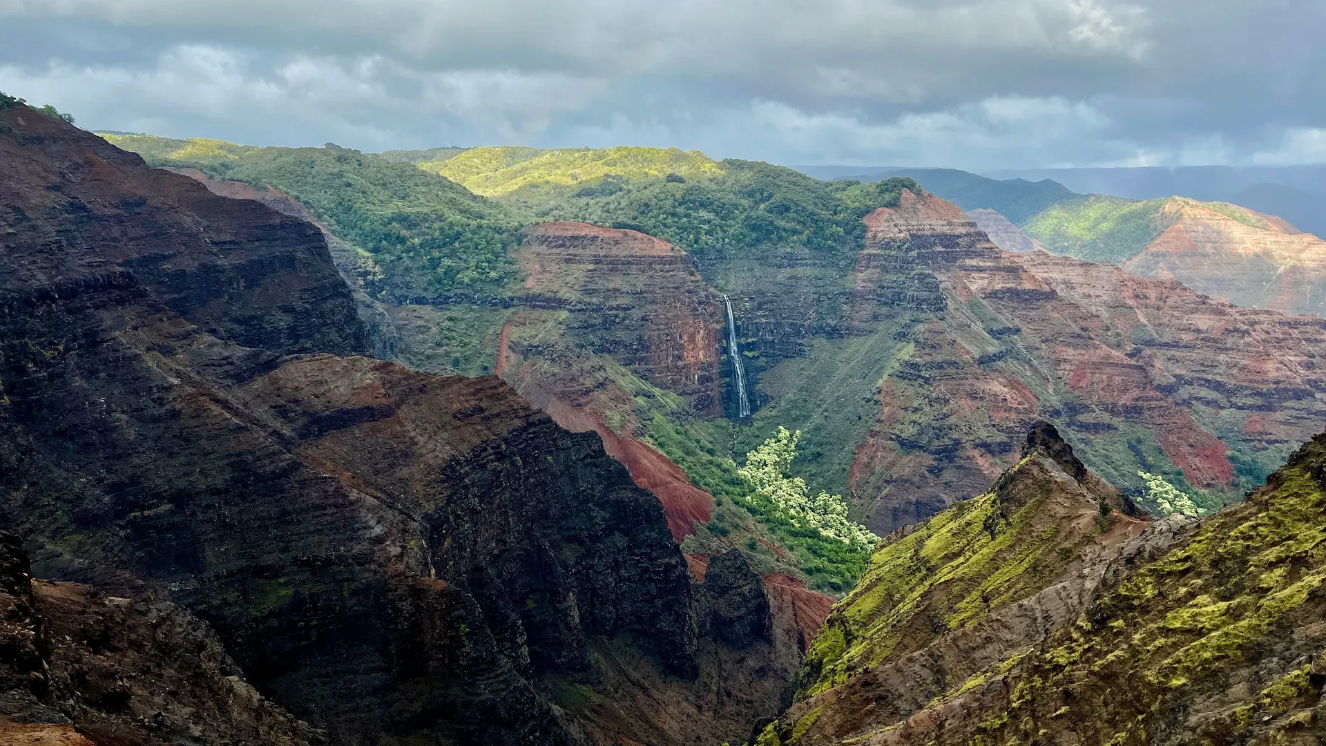
Waimea Canyon cuts a 14-mile gorge into the western side of Kauaʻi, dropping 3,600 feet to the river below. The massive depression exposes layers of red volcanic soil and green vegetation, ending where the high forest meets the Nāpali Coast.
Fourteen miles of fractured basalt and red clay tear through the western half of Kauaʻi. Waimea Canyon drops 3,600 feet from the high-elevation rim down to the Waimea River. The state park covers 1,866 acres of wilderness, ending where the road climbs into the adjacent Kōkeʻe State Park.
Visitors stand on paved overlooks at 3,640 feet above sea level, looking down at layers of rusted volcanic rock. Trade winds push fog over the canyon edges. The temperature drops 10 to 20 degrees Fahrenheit compared to the beaches at sea level. Rain from Mount Waiʻaleʻale feeds the river at the canyon floor, constantly eroding the rock.
Sightseeing requires navigating a steep, 26-mile round-trip drive up Route 550. The road climbs 4,000 feet through sharp switchbacks. Gas stations do not exist past Waimea town. Running out of fuel on the mountain means paying for an expensive tow.
Thick clouds regularly erase visibility at the lookouts by midday. Arriving before 10:00 a.m. provides the cleanest light on the east-facing cliffs and avoids the heaviest crowds. A single $10.00 parking receipt covers all viewpoints in both Waimea Canyon and Kōkeʻe State Parks for the entire day.
The scenic drive is fully accessible by car. Paved overlook areas at the main Waimea Canyon Lookout accommodate wheelchairs and strollers. Designated accessible parking spaces sit adjacent to the viewing platforms. Restrooms at the Puʻu Ka Pele picnic area meet ADA accessibility standards. Unpaved hiking trails within the park feature steep grades and stream crossings, making them unsuitable for wheelchairs or strollers.
Elderly visitors can view the dramatic drops directly from the paved platforms with minimal walking. Children require close supervision because steep drop-offs lack guardrails in many areas. Staying behind official barriers prevents fatal falls.
Non-residents pay a $5.00 entry fee per person, though children ages three and under enter free. Parking costs $10.00 per standard non-commercial vehicle. Commercial PUC vehicle parking rates scale from $25.00 for 1-7 passenger vehicles up to $90.00 for vehicles carrying 26 or more passengers. Hawaii residents enter free with a valid state driver's license or ID.
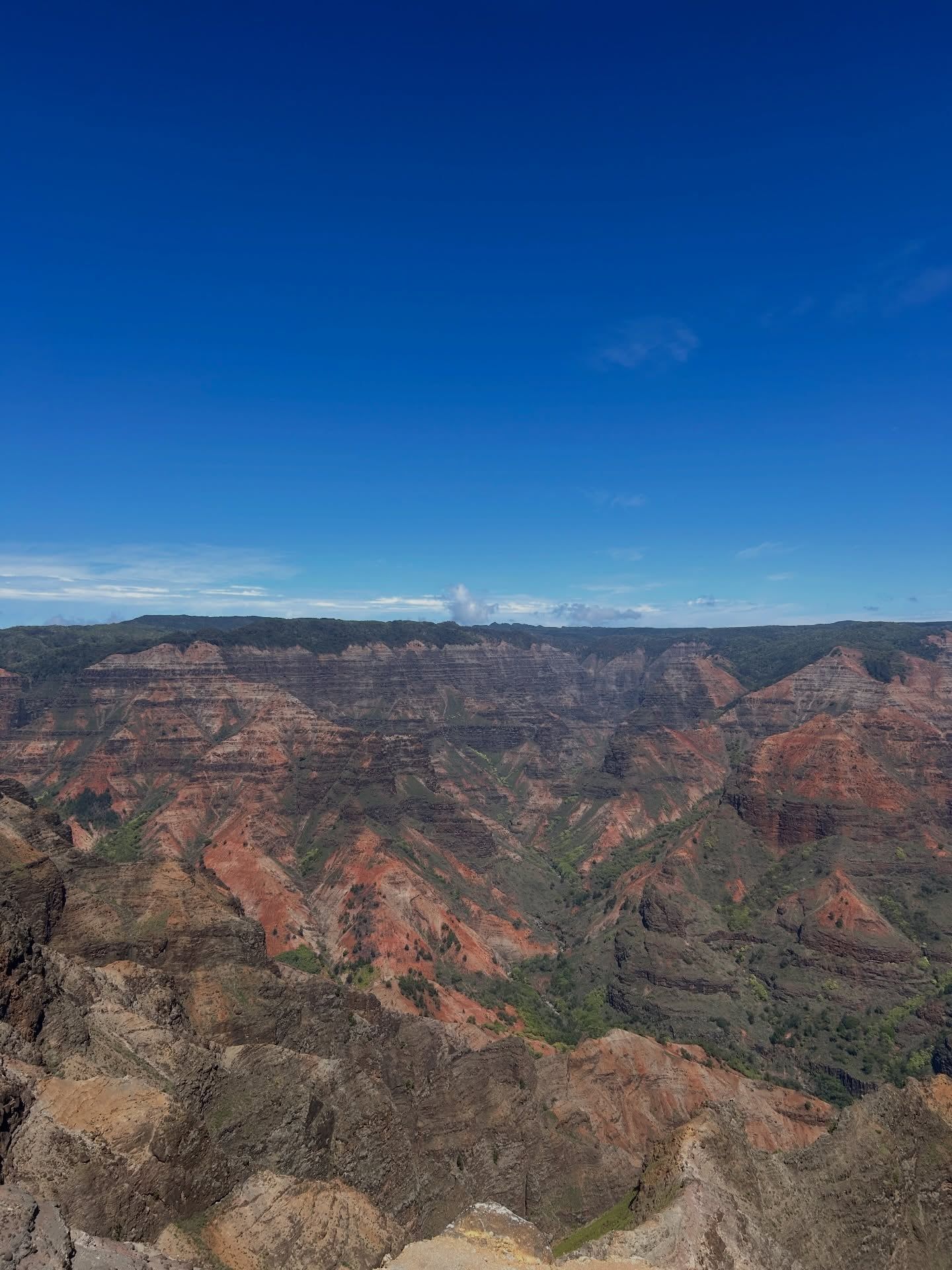
Catastrophic volcanic collapse and steady water erosion carved the 14-mile gorge. Mount Waiʻaleʻale dumps extreme rainfall onto the central plateau. This water funnels into the Waimea River, slicing through the shield volcano's lava and basalt fields over millions of years. A massive fault line caused a portion of the island to collapse, accelerating the canyon's formation and exposing distinct layers of red volcanic soil. The resulting depression measures up to one mile wide and 3,600 feet deep.
Native Hawaiians utilized the canyon and its surrounding forests for centuries. They gathered timber, hunted birds for feathers, and navigated the steep ridges. The name "Waimea" translates to "reddish water," a direct observation of the river turning rusty red as rain washes the iron-rich soil downstream. By the 20th century, the uplands of Kōkeʻe and Waimea transitioned into recreational areas. The territory began leasing lots for recreational residences, establishing a small community of cabins in the high-elevation forests.
Route 550, known as Waimea Canyon Drive, opened the area to vehicular traffic. The paved road climbs 4,000 feet from the coast over an 11-to-18-mile stretch, requiring constant maintenance against landslides and heavy rain. The state completed appraisals for rent reopeners on the recreational leases in 2022, with the current agreements expiring in 2031. Kōkeʻe Lodge was established near the top of the park road, providing the only dining option and hot meals for visitors exploring the remote area. The restaurant operates Monday through Friday from 10:00 a.m. to 4:30 p.m., opening thirty minutes earlier on weekends.
Maintaining access to the 3,600-foot-deep gorge requires significant ongoing investment. The Hawaii Department of Land and Natural Resources schedules major infrastructure improvements to combat erosion and wear. The main Waimea Canyon Lookout will close entirely from July 14, 2025, to January 9, 2026, for safety upgrades. Extensive road resurfacing projects on Waimea Canyon Drive will follow in mid-2026, causing daily closures between Maule and Kōkeʻe Road. The Kōkeʻe campground will also shut down for major improvements from May 2026 through spring 2027. Visitors planning trips during these windows must check the official state park website for detour information and updated access schedules.
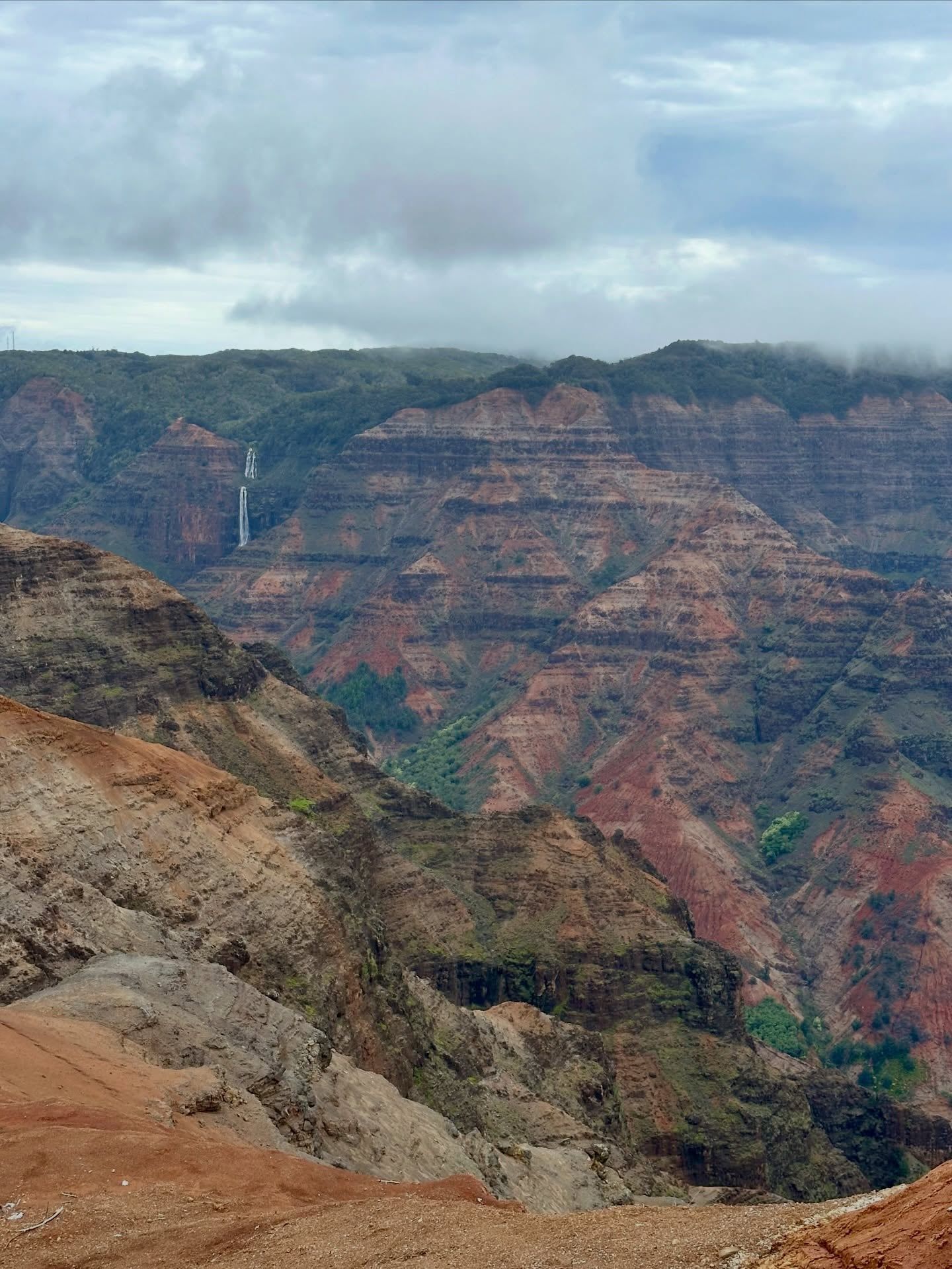
Eighty meters of cascading water drop over the two-tiered Waipoʻo Falls. The 800-foot waterfall cuts directly through the canyon's eastern wall, visible from the main lookout at mile marker 10. The surrounding cliffs display horizontal bands of red, brown, and green, marking different lava flows from the island's shield-building phase. The Canyon Trail leads hikers directly to the top of these falls through native forests, requiring two to three hours for the round trip.
The gorge measures up to one mile wide and plunges 3,600 feet deep. Rusted volcanic soil covers the exposed ridges. This iron-rich dirt turns into a slick, dangerous clay after heavy rain. Hiking the unpaved Canyon Trail or Cliff Trail requires sturdy, closed-toe boots with deep tread. The red dirt permanently stains clothing, footwear, and skin.
At mile marker 13.5, the Puʻu Hinahina Lookout sits at an elevation of 3,640 feet. This vantage point provides a cross-section view down the canyon corridor toward the Pacific Ocean. On clear winter mornings, the private island of Niʻihau appears on the horizon, seventeen miles offshore.
Higher up the mountain, the environment shifts from dry canyon walls to wet fern forests. The 0.3-mile Iliau Nature Loop showcases endemic flora adapted to the high rim. This short, flat trail features educational signage identifying native plants and provides sweeping views with minimal physical exertion.
Further up the road in Kōkeʻe State Park, the Puʻu O Kila Lookout looks down into the deep Kalalau Valley from thousands of feet above the ocean. Flash flooding remains a severe risk in the gulches below the rim. A sudden wall of water can rush down the Waimea River even when the rim overhead is sunny, driven by storms miles away on Mount Waiʻaleʻale.
On the drive up, the Red Dirt Falls serves as a unique roadside stop. Water runs red as it cascades over the rusty volcanic soil. Drivers must use designated pullouts rather than stopping in the middle of the road to photograph these features.
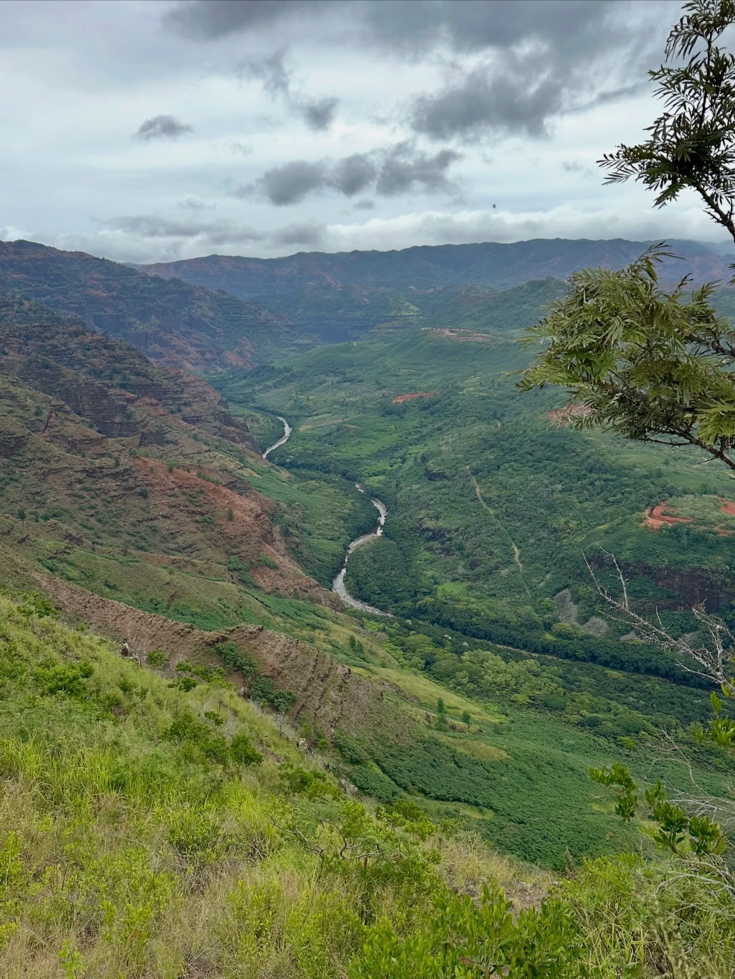
Hawaiian naming conventions document the physical reality of the landscape. "Waimea" translates to "reddish water." Heavy rains strip the iron-heavy volcanic soil from the canyon walls, bleeding it into the river and carrying the rust color all the way to the ocean. The name serves as an ancient, practical weather warning for flash floods originating in the highlands.
The surrounding forests protect ecosystems that survive only at high elevations. Native birds, including the ʻiʻiwi and ʻapapane, rely on the ʻōhiʻa lehua trees growing along the canyon rim. These trees face a severe threat from Rapid ʻŌhiʻa Death, a devastating fungal disease. The Kōkeʻe Natural History Museum, located next to Kōkeʻe Lodge, provides detailed exhibits on these endemic bird species and the canyon's geological formation. Entry to the museum is free, and a typical visit takes ten minutes.
Hawaiian law and tradition prohibit the removal or disturbance of natural resources. Taking rocks, plants, or soil from the canyon violates state regulations and disrespects the land. Agricultural quarantine rules strictly ban moving ʻōhiʻa wood, parts, or soil off Kauaʻi to contain the fungus. Visitors must clean all mud from their boots using a brush and 70% rubbing alcohol before entering and after leaving the forest trails.
After a long day of hiking, many visitors drive back down the 4,000-foot descent to Kekaha Beach. Located at the base of Kōkeʻe Road, this expansive beach provides public restrooms and picnic areas under active lifeguard surveillance. Overnight camping in the canyon requires a valid permit from the DLNR reservation site. Backcountry campsites sit at the bottom of the gorge, demanding a grueling hike down and back up the steep walls.
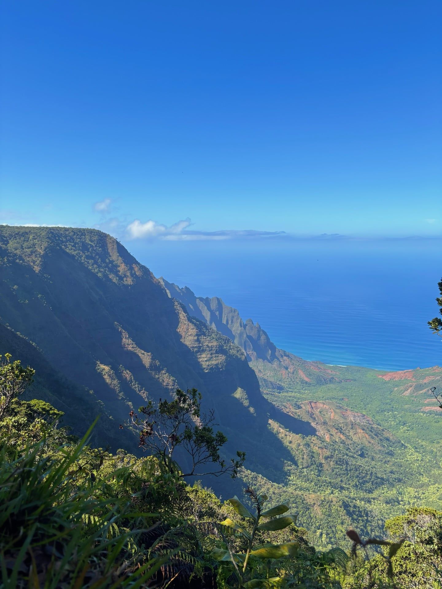
The Waimea River runs red after heavy rainfall due to the erosion of iron-rich volcanic soil.
The canyon was formed by a combination of steady river erosion and a massive volcanic fault collapse.
The river is fed by Mount Waiʻaleʻale, recognized globally as one of the wettest places on earth.
From the Puʻu Hinahina Lookout, you can see the private island of Niʻihau 17 miles offshore.
Temperatures at the canyon rim routinely drop 10 to 20 degrees Fahrenheit lower than at sea level.
The red volcanic dirt found throughout the park will permanently stain clothing, skin, and shoes.
Flying drones is strictly prohibited anywhere within Waimea Canyon State Park to protect native wildlife.
Non-residents pay a $5.00 entry fee per person and a $10.00 parking fee per vehicle. Hawaii residents enter and park for free with a valid state ID. A single payment covers both Waimea Canyon and Kōkeʻe State Parks for the entire day.
No advance reservations are required for day-use sightseeing or parking. Visitors pay the entry and parking fees directly at self-service kiosks located in the main lots. Camping in the adjacent Kōkeʻe State Park does require a valid permit from the DLNR reservation site.
The drive covers 11 to 18 miles from Waimea town, depending on how far up the mountain you go. The paved road climbs 4,000 feet in elevation through numerous sharp switchbacks. A basic sightseeing trip stopping at the main lookouts takes about 1.5 to 2 hours.
Yes, the major viewpoints are accessible directly from the parking lots. The main Waimea Canyon Lookout and Puʻu Hinahina Lookout feature paved paths that take under a minute to walk. Elderly visitors and families with young children can easily view the gorge without navigating unpaved trails.
Early morning provides the clearest views and the cleanest light on the east-facing cliffs. By midday, trade winds often push thick clouds across the rim, which can completely block visibility. Arriving before 10:00 a.m. also helps secure parking before the lots fill up.
There are no gas stations anywhere along the canyon road or inside the state parks. Drivers must fill up their tanks in Waimea town before starting the climb. Kōkeʻe Lodge is the only dining option, serving food daily until 4:30 p.m.
Hiking immediately after heavy rain is highly dangerous. The red volcanic soil turns into slick, clay-like mud that causes severe slipping hazards. Winter storms also increase the risk of sudden flash flooding in the canyon's streams and gulches.
The soil contains high levels of iron from the island's basalt lava rock. As the rock weathers and oxidizes over millions of years, it rusts. This creates the prominent red dirt that permanently stains shoes and clothing.
Drones are strictly prohibited in all Hawaii State Parks. Visitors cannot fly them anywhere within Waimea Canyon or Kōkeʻe State Park. This rule protects native wildlife, preserves the environment, and prevents disturbances to other visitors.
Rapid ʻŌhiʻa Death is a severe fungal disease killing native trees along the canyon rim. Visitors must clean all soil off their shoes and spray their gear with 70% rubbing alcohol before and after hiking. It is illegal to transport ʻōhiʻa wood or soil off the island of Kauaʻi.
Browse verified tours with free cancellation and instant confirmation.
Find Tours